Pages

Monday 28 July 2014

Lake District Wild Camp 23-24/7/14

I arrived a little later than planned at just after 1pm and after failing to find a free parking space I parted with some money and parked at Side Farm.
After a short stroll I was soon making my ascent of St Sunday Crag via Thornhow End, with no breeze it was absolutely sweltering up the steep slope and progress was slow.

Ullswater from Thornhow End.
As I gained height the gradient relaxed and the wind increased making walking much more bearable, the views also opened up over Grisedale and beyond.


I came across an ice cold stream and decided it would be wise to carry a couple of extra litres just in case I struggled to find water later on.
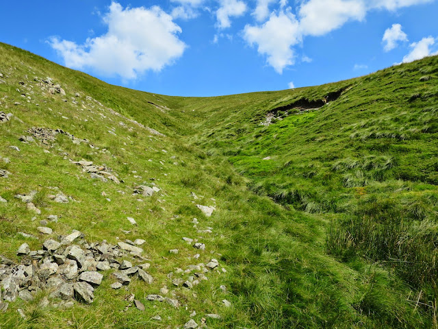
The final stretch seemed to take ages with Fairfield and Grisedale Tarn slowly looming into view


After a quick rest shortly after the summit, I began the relaxed descent of Deepdale Hause, hoping the ascent of Cofa Pike and Fairfield were not as exposed as they looked.


Cofa Pike from Deepdale hause.
I found the short scrambly climb a little exposed in a couple of areas, but on the whole it was nothing to worry about.

Looking back at St Sunday Crag.

Time was cracking on and I made the short ascent to Fairfield's summit without my pack on.
The plan was to ascend and set up camp on Seat Sandal but I was knackered and needed food so I decided to head to the far end of Grisedale Tarn away from the crowd of tents pitched near the stepping stones.


Fairfield above Grisedale Tarn.
When I finally plonked down onto the grass I fired up the Jetboil and savoured the tasty meatballs and pasta.
As I sat there the thought of taking a dip in Grisedale Tarn was too much!
It was the perfect antidote to a long days hiking in the baking sun, the cooling water easing the days strains.
Once out and dry the sun starting dipping down and I was left sitting in the shade despite it still being a couple of hours before sunset.
I decided to pack up and keep to my original plan of making camp on Seat Sandal, there's no way I was missing out on this sunset!

Grisedale Tarn with St Sunday Crag directly behind.
I took the most direct route which was fairly steep but pleasant as it was now getting cooler.
As I reached the peak of Seat Sandal there was a tent already pitched so I went hunting for a level pitch free of rocks.
When I eventually found my spot there were two small pools of water nearby which was a bonus, I set about pitching my tent making sure the front was firmly anchored before inserting the poles as the wind wasn't taking any prisoners!

Force 10 Ion 2 pitched on Seat Sandal.
Just before sunset I heard a slow roar approaching, I ran for a clear view of the valley below and saw two lots of five aircraft in two separate V formations slowly flying North over Thirlmere Reservoir, it was a fantastic sight.


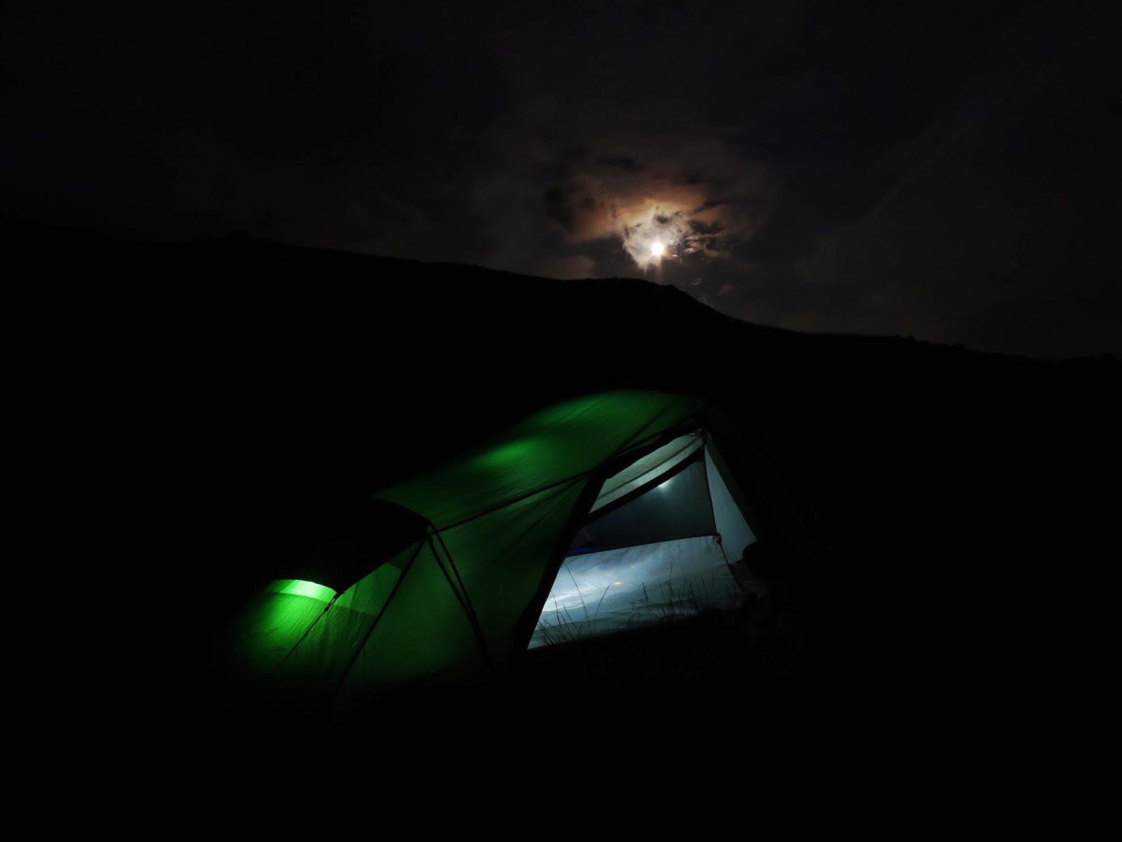
When the sun had well and truly set I had a quick meal and settled down to sleep with the wind now whistling down the surrounding hillside.
After a decent sleep and in a confused slumber I turned my alarm off and woke by chance a short time later, I quickly dressed and stumbled out of the tent towards a decent vantage point.
I got there with a couple of minutes to spare, St Sunday Crag just managing to contain the sun's brightness while I took a couple of pictures.

Seconds before sunrise over St Sunday Crag.


As I made my way back to the tent the sun was rising fast and beginning to light up distant peaks.
Breakfast was had and I packed up camp, slowly meandering my way off Seat Sandal.

Southern side of Dollywaggon Pike.
I opted to take a direct route up Dollywaggon Pike, unfortunately this forced a very steep climb up its Southern side.
It seemed to take an age, no doubt the frequent breathers needed assisted with that!
As I reached the top of the I had a rest at the post while enjoying a well earned drink from my vantage point.
I carried on the short distance towards the summit and took in the breathtaking views between the North and East.

Looking East to St Sunday Crag from Dollywaggon Pike.
The going would now get a lot easier as the path North towards High Crag and Nethermost Pike had very little elevation change
I passed a few small groups all heading in the opposite direction.


Striding Edge and St Sunday Crag.
As I reached the trig point I put my pack down to give my shoulders a rest.
The summit was crowded and I struggled to take pictures, shortly after I left the summit and headed towards Whiteside Bank.

Swirral Edge and Red Tarn.
My next worry was water, I was on my last bottle full and the sun was beating down, Red Tarn was out of the question as I'd have to tackle Swirral Edge.

Brown Cove and Catstye Cam.
I opted to drop down to Helvellyn Gill as there was nothing near to the main path, thankfully a short way down I heard the babbling of a nearby stream.

Browncove Crags.
I filled up my bottle and reservoir with deliciously clear ice cold water, spending a short time relaxing while taking in some peaceful views.


Travel Tap and Sawyer filter connected to a Platypus 3L reservoir.
I took a direct route up Whiteside Bank which wasn't too steep, once back on the main path all the other walkers seemed to have disappeared despite it still being early afternoon.

Helvellyn.
Catstye Cam.
I arrived at Raise just after 5pm and found a quiet spot looking West over Thirlmere, I kicked off the boots and relaxed in the sun listening to music for a good couple of hours.
The day had gone so slowly and it was nice not having any pressure trying to get to a peak before sunset.
As I'd done 'the usual' of skipping lunch I had a double portion meal for tea.
After picking up a few important items I took a quick bearing on Brown Crag and set off to find a nearby stream, unfortunately it wasn't big enough for bathing and I headed back to where I thought I'd put my stuff.
I couldn't see my pack anywhere and searched around for a short while, eventually I gave up and followed the bearing line back to my stuff (a lot lower than I'd been searching).


After watching the last of the days walkers disappear off Raise I picked up my towel and reservoir and headed back down to the stream I found earlier, after emptying 9 litres of breathtaking but refreshing ice cold water over myself I dried off and headed back to camp, yet again misjudging where I'd put my stuff!
This time a shining tent stuffsack guided me back.
As it was getting close to sunset I pitched the tent, failing to insert the pegs fully due to the thin grassy surface layer having solid rock underneath it.

Force 10 Ion 2 pitched on Raise.


After another stunning sunset I retired indoors and listened to music for a bit, the wind had started to pick up again a short time later as I headed to bed.
After silencing my alarm and getting dressed I clumsily made my way up the rock strewn slope towards a decent vantage point, timing it perfectly yet again!

Sunrise over Ullswater.

I slowly made my way back to camp, determined to get a couple more hours sleep.
It did me the world of good and I had breakfast and packed up just before the sun started to make things uncomfortable, a couple of early morning hikers were making there way up Raise as I made the descent towards Sticks Pass.

Looking North to Stybarrow Dodd.
Looking West over Thirlmere Reservoir.
The descent was gradual with great all round views, ideal for a nice amble back to the car.

Looking back at Raise.
Glenridding.
Despite flawless navigation throughout my trip I did manage to miss a footbridge over Glenridding Beck which forced me to take a slightly different route towards Lanty's Tarn.
After a quick break in the shade next to Glenridding Beck and a top up of water I carried on to Lanty's Tarn which had definitely seen better days

Glenridding Beck.
Lanty's Tarn.
As I skirted around the Brownend Plantation and headed back down the lane I'd come up a couple of days previous I was grateful for the end to be in sight, my pack and boots really making themselves felt.
I'd had the most amazing weather over a couple of excellent days walking and camping, but even though I do love summer, I'm starting to long for some winter conditions :)

Map of route below:
http://gb.mapometer.com/walking/route_3902864.html

Sunday 20 July 2014

Gear List

A list of tried and trusted gear that I currently use.

Tents
MSR Hubba HP
Hilleberg Niak
Terra Nova Voyager 2.2
Vango Tornado 200

Sleeping
Cocoon Air Core Travel Pillow Ultralight
Exped SynMat UL Lite (M) sleeping mat
Exped DownMat UL 7 (M) sleeping mat
Rab Mythic 200 sleeping bag
Rab Mythic 400 sleeping bag
Rab Mythic 600 sleeping bag
Rab Neutrino 800 sleeping bag
Cocoon microfibre mummy bag liner
Alpkit Akun sleeping bag liner

Backpacks
Osprey Talon 44
Osprey Talon 55
Osprey Kestrel 58
Osprey Aether 70

Mapping
Ordnance Survey Explorer 1:25000
Viewranger phone app

Hydration
Sawyer Squeeze filter
Platypus Hoser 2 litre reservoir
Hario Mini Mill hand coffee grinder
Wacaco Nanopresso (with Barista kit)
Life Venture thermal mug
Hydrapak SpeedCup

Stove
MSR Windburner

Food
Real Turmat, Bla Band, Be-Well expedition.

Clothing
Lorpen T3 lightweight hiker socks
Montane Dart base-layer boxers
Montane Dart base-layer t-shirt
Salomon Panorama mid-layer fleece
Montane Atomic waterproof jacket
Mountain Hardwear Ghost Whisperer down jacket
Montane Nitro down jacket
Craghoppers Kiwi Pro stretch trousers
Berghaus waterproof overtrousers
Rab Argon down trousers
Rab Powerstretch gloves
Trekmates Classic Dry gloves
Montane Yukon beanie
Mountain Equipment neck gaiter
Oakley sunglasses (various)
Rab Latok Alpine Gaiters
Scarpa Terra GTX boots

Lighting
Alpkit Muon headtorch
Petzl Actik Core 600 headtorch
Alpkit Prism 550 headtorch
Streamlight ProTac (750 lumen) torch
Black Diamond Moji lantern

Winter Gear
Grivel Munro ice axe
Yaktrax ice grips

Misc
Lifesystems survival shelter (bothy bag)
Multimat folding sit mat
Victorinox Rally pocket knife
EasyAcc 10,000mAh power bank
Anker 20,000mAh power bank
EasyAcc 20,000mAh power bank
EasyAcc 26,000mAh power bank
Anker Soundcore speaker
Handy Heroes microfibre clip towel
Mountain Warehouse towel
Sea to summit pocket trowel
First aid kit (mixture of items)
Alpkit Clippers (mini carabiners)
Exped drybags
Karrimor drybags

Camera Gear
Canon EOS M6 mk2 camera
Canon EF-M 18-150mm, EF-M 22mm and EF 100mm Macro lens
DJI Mavic Mini drone
Manfrotto MKC3-H01 Tripod
Lowerpro camera bag

Bothy Gear
Exped Sim 2.5 sleeping mat
Victorinox Camper pocket knife
Bahco Laplander folding saw
Silky Bigboy 2000 folding saw
Fiskars X7 chopping axe
Fiskars X10 chopping axe

Bushcraft Gear
DD Hammocks 3x3m Tarp
DD Hammocks Scout
DD Hammocks Underblanket
DD Hammocks Tree huggers
Black Diamond Neutrino snapgate carabiners
TBS 750ml titanium cooking pot

Packraft Gear
Nortik Trekraft with deck
Nortik Allround 4-piece 240cm Fibreglass Paddle
Yak Blaze PFD/life vest
Ortlieb drybags

Sunday 13 July 2014

Kinder Scout Wild Camp 11/7/14

After a mad dash from work and then home, I parked up in Hayfield at 18:30 and set off on my way.
My initial plan was to skirt around Kinder Reservoir clockwise and make my way up towards Cluther Rocks but due to my late arrival I opted to head towards Kinderlow End.
Even though my navigating has improved I did struggle through the first section as It's very compact.
As soon as I passed Tunstead Clough Farm things got easier as I was out in the open Countryside, my only problem now was being constantly mithered by flies in the heat.


Looking West from Kinderlow End.
As I left the grassy fields behind I made my way up Kinderlow End and came across the most magnificent caterpillar crossing the path in front of me, it froze when it sensed me which made for easier photographs.
After a short while of me taking photographs it carried on its journey so I did the same.


Oak Eggar caterpiller.
I resisted the temptation to search for the Kinderlow cavern and carried on towards the Three Knolls spotting a couple of silhouettes on the path above me.
I was pleasantly surprised by the many patches of Cottongrass bobbing about in the light evening breeze.


I knew the Red Brook would be doubtful for water (it was only a trickle last time I was here) unfortunately my guess was correct, it was bone dry.
My next (and last!) option for water was Kinder Downfall, I could hear the River Kinder noisily flowing below so I knew it wouldn't let me down.

Looking down Red Brook.
It wouldn't be long till the sun appeared out of the clouds and set so I pushed on for the final kilometre towards Downfall.
When I reached Downfall I was shocked, I stood there gawping at a dry stream bed with two stagnant pools of water my only option.
I climbed down the rocks to the biggest of the pools, the dead flies on top making me feel slightly sick.
I filled up the Travel Tap and Sawyer and made my way to some high rock for a brilliant view of the impending sunset.


My timing was spot on, shortly after I'd sat down the sun began to drop below the cloud slowly releasing a magical orange glow, I sat there on the rock transfixed by the beauty of it all.


Sunset from Kinder Downfall with Mermaids Pool (bottom left).
As the sun was about to disappear beyond my line of sight I headed South East to enable me to view its entirety.


By the time I'd left my second rock it was getting late so I headed off the beaten track in search of a decent spot to pitch, I never found it as the ground was lumpy and covered in thick stubborn vegetation.
On the plus side I would have great views when morning time came.
As soon as the tent was pitched and stuff unpacked I treated myself to a boil in the bag curry and a bottle of Bulmers, a perfect way to end a manic Friday!


I had a peek outside and saw the moon was slowly rising over Kinder Low, I donned the boots and grabbed the tripod but despite my best efforts I struggled with the lighting inside the tent.

Moon rising over Kinder Low.
Despite a waking up a few times with dead arms, I'd slept quite well and was finally woken by the sun's heat turning my tent into a greenhouse!
Over breakfast I decided I'd take a completely new route to further hone my navigational skills.
A fair while later I departed and headed roughly East back towards Hayfield.

Looking over to Kinder Reservoir and beyond.
Sandy Heys from my camp.
I didn't pass or see anyone on my slow amble back towards civilisation, taking my time to ensure my navigation was spot on.

Cottongrass with Kinder Downfall in the distance.
As I neared the small wood just South of the Kinder Reservoir I took off my pack to photograph some of nature's little jewels that often get overlooked.


As the Reservoir buildings loomed into view I bear left passing Farlands and began passing people on there way up and around Kinder.
As I joined Kinder Road I exchanged a polite 'morning' with an older Gent who was returning to Hayfield from a morning walk, turns out he was into wild camping and rock climbing in his younger years and often frequented the Lakes too! Small world eh? 
As I neared the car I realised that my next adventure (Helvellyn) is only a couple of weeks away and I can't bloody wait! :)

Map of route below:
http://gb.mapometer.com/walking/route_3894438.html